Laser Scanning & Point Cloud – Western Links Sign, North Melbourne
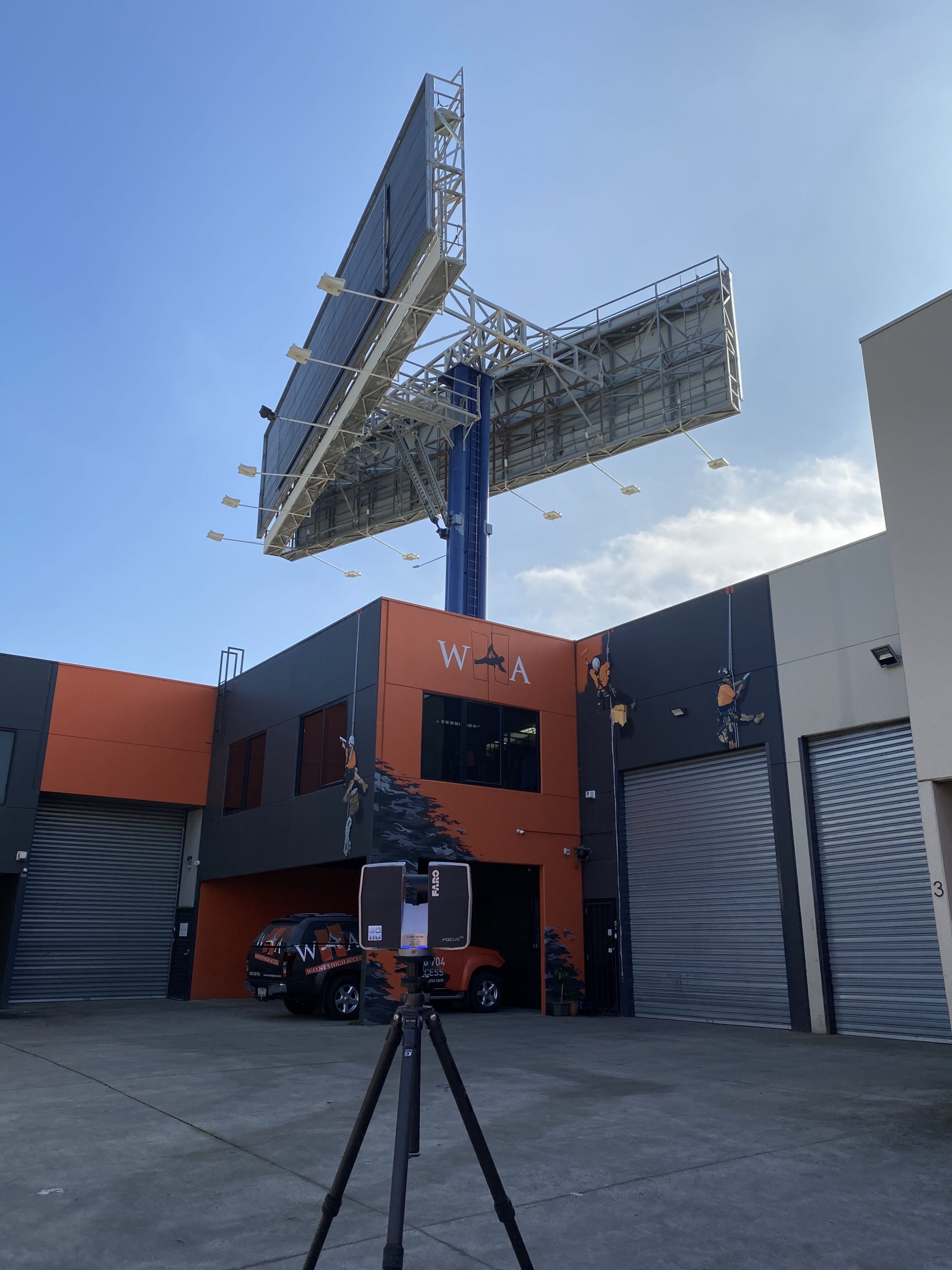
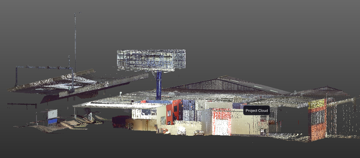
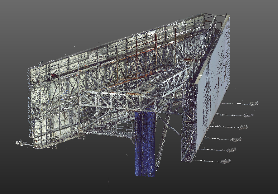
Swanson Surveying were recently engaged to undertake a Laser Scanning Survey to assist in planning works for the decommissioning of the Western Link Sign in North Melbourne. With the sign standing approximately 20m above the ground and in close proximity to Citylink elevated toll road and several buildings, Laser Scanning was utilised to provide a full capture of the surrounding areas so that detailed planning works could be undertaken to help determine the weight and the centre of gravity of the sign, and the safest way to lift the sign back to the ground.
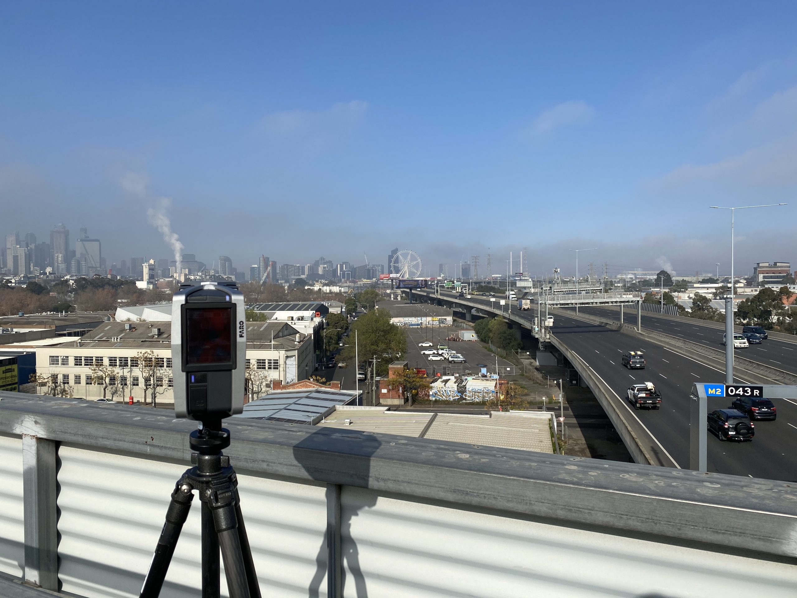
Although a challenging site with limited roof access, our surveyor was able to get either side of the sign by climbing the access ladder with our light-weight Faro Scanner. Utilising the maintenance platforms on top of the sign provided several additional vantage points for scanning the sign that traditional survey techniques would not have been able to perform. Not to mention the view of the surrounding CBD from the sign.
The client received a colourised, universal format point cloud data file that can be imported into any Point Cloud Software Package such as Revit, ArchiCAD, Realworks and Cloudworks for example.
If you would like more information regarding the benefits of Laser Scanning for your next project, please don’t hesitate to contact us today.
Laser Scanning