Laser Scanning & 3D Modelling
Laser scanning and 3D modelling services in Geelong, Melbourne, Ballarat, regional Victoria and Colac
Laser scanning
Laser scanning allows the mass capture of highly accurate data, to form a point cloud. The point cloud data can then be used to create 3D models for use in many aspects of the design process. Our team has experience in a diverse range of laser scanning and 3D modelling projects, stretching from small-scale residential projects to complex industrial developments and large public buildings.
Swanson Surveying use Faro Scanners and Trimble Real Works Software to survey and collate data for use in:
- Building design and documentation
- Building Information Modelling (BIM)
- BIM for building facility management databases
- Heritage assessments
- Engineering applications
- Reverse engineering
- Pipework design
- Roading
- Infrastructure assessments
- Deformation monitoring
- Asset management and recording.
3D modelling
We can also provide our clients with 3D models of the point cloud suitable for use in AutoDesk Revit, ArchiCAD and CAD. These 3D models are survey accurate and can be used for design, documentation, asset management and marketing purposes.
Our Standard 3D Model includes core building elements in 3D which allows the user to understand the building in greater depth, assisting with identifying conflicts early on and better visualisation of the space for clients. Can be incorporated with a 2D floor plan if requested.
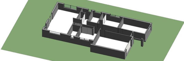
Standard 3D Model
Our Extended 3D Model includes all the standard fundamental building elements as a base but can then be further customised to suit the individual client, project and purpose. This allows us to meet our client’s needs without blowing the budget on unnecessary data and time.
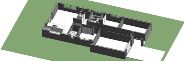
Extended 3D Model
Building floor plans
Swanson Surveying can also provide 2D Building Floor plans, delivered in AutoCAD DWG and PDF formats, to give owners and other professionals a cost-effective understanding of a building layout.
Our Standard Building Floor Plan includes core building elements such as internal & externals walls, floors & ceiling levels, internal & external door and window positions, and exposed columns.
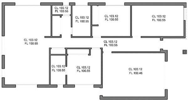
Standard Building Floor Plan
Our Architectural Building Floor Plans have the same standard inclusions with additional dimensions for all doors & windows. This extra information is great for a more detailed understanding of the building and its foundation movements. The plan presentation is more traditional for Architectural plans.
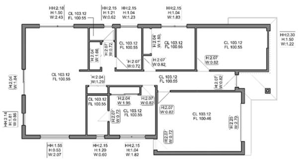
Architectural Building Floor Plan
Please contact Swanston Surveying to discuss your next project or arrange your free quote. We offer a wide range of services across Geelong, Melbourne, Colac and Ballarat including land surveying, engineering surveying and construction surveying.
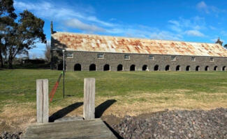
Laser Scanning & 3D Modelling – Cape Otway Road, Birregurra
Our team recently undertook a unique surveying project at Cape Otway Road, Birregurra, applying advanced...
Read more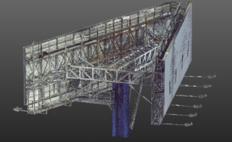
Laser Scanning & Point Cloud – Western Links Sign, North Melbourne
Swanson Surveying were recently engaged to undertake a Laser Scanning Survey to assist in planning works...
Read more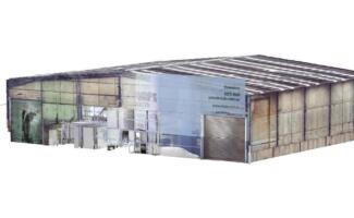
Laser Scanning & 3D Modelling – Abbotsford, Melbourne
Swanson Surveying was recently requested to provide a 3D CAD model for planning and design...
Read more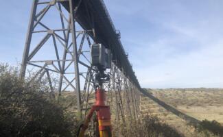
Laser Scanning – Maribyrnong Railway Viaduct, Melbourne
Swanson Surveying was recently contracted to undertake a 3D laser scanning survey of the support pylon...
Read more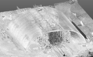
Laser Scanning – Drysdale Bridge near Geelong
The team at Swanson Surveying were recently engaged to undertake an as-built survey of a new...
Read more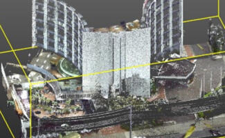
Laser Scanning – Rydges Hotel, Geelong
In October Swanson Surveying undertook a laser scanning survey for the redesign of the interior...
Read more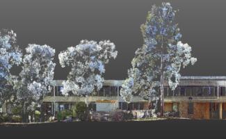
Laser Scanning – Deakin University Waurn Ponds, Geelong
Swanson Surveying was recently engaged to undertake a feature and level survey of the facade...
Read more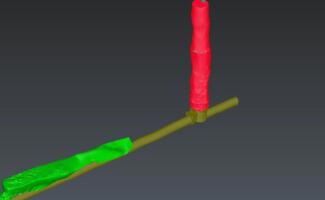
Laser Scanning – Drainage Tunnel, Warrnambool
Swanson Surveying was recently engaged to undertake a laser scanning survey of an underground drainage...
Read more
Laser Scanning & 3D Modelling – Performing Arts Centre, Geelong
Swanson Surveying was recently involved in an exciting laser scanning and 3D modelling project at the...
Read more
Laser Scanning & 3D Modelling – Coles Hawthorn, Melbourne
Swanson Surveying has recently been involved in a large laser scanning and 3D modelling project...
Read more