No title available

Engineering Surveying – Barwon Health Women and Children’s Hospital
Read MoreThe Victorian Government has committed more than $500 million to deliver new and expanded women’s and children’s services in Geelong. Operated by Barwon Health, the new facilities will be built within the University Hospital Geelong precinct and will house a...
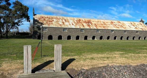
Laser Scanning & 3D Modelling – Cape Otway Road, Birregurra
Read MoreOur team recently undertook a unique surveying project at Cape Otway Road, Birregurra, applying advanced laser scanning technology to measure a 150-year-old bluestone shearing shed. The task involved capturing precise data of the entire structure—internally, externally and underneath the floor...
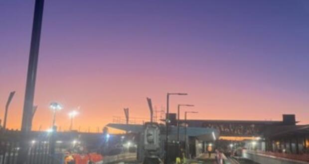
Engineering Surveying – South Geelong to Waurn Ponds Rail Upgrade
Read MoreSwanson Surveying are currently completing engineering construction surveying for the South Geelong to Waurn Ponds Duplication project as part of the Australian and Victorian governments’ $1 billion Geelong Rail Line investment. The works include the upgrade of the South Geelong...

Engineering Surveying – Nyaal Banyul Geelong Convention and Event Centre
Read MoreThe Nyaal Banyul Geelong Convention and Event Centre precinct is the centrepiece project of the Geelong City Deal and has a project value of $456 million. The precinct will include the construction of the purpose-built convention and exhibition space, incorporating...

Civil Construction Surveying – Golden Plains Wind Farm
Read MoreOne of Swanson Surveying’s latest renewable energy projects is the Golden Plains Wind Farm, a significant Victorian venture that will be Australia’s largest wind farm to date and power more than 765,000 homes. This $3 billion plus project is a...
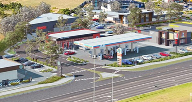
Multi Lot Subdivision – Sunshine Ave, St Albans
Read MoreThis mixed-use commercial development is based at the gateway to St Albans. With vast main road exposure, the site adjoins Melbourne’s Western ring road and sits amongst the residential catchment of St Albans. The project proposes a mix of retail...
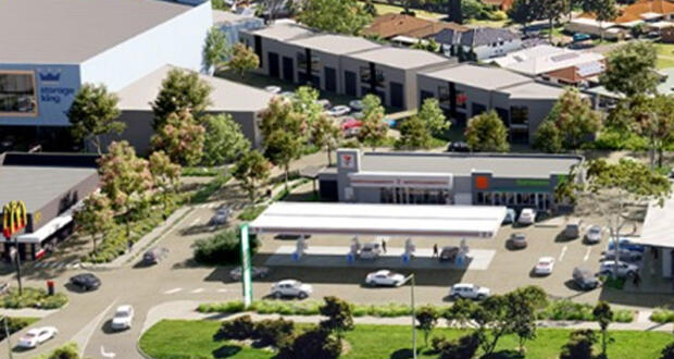
Multi Lot Subdivision – Grovedale Village, Waurn Ponds
Read MoreSwanson Surveying have been involved in the planning and construction of a mixed-use retail development on a major intersection in the heart of Waurn Ponds, Geelong. The site is surrounded by the Waurn Ponds Shopping Centre, Homemaker Centres, Bunnings, and...
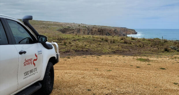
Coastal Cliff Land Survey – Allansford
Read MoreSwanson Surveying was recently contracted to provide a feature and level survey of a future house development site atop of a cliff facing out across Bass Strait. The purpose of the land survey was to assist the client with determining...
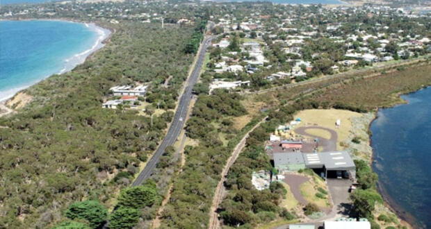
UAV Survey – Bellarine Railway Rehabilitation, Drysdale to Queenscliff
Read MoreAnother example of the benefits of utilising UAV survey technology for precise aerial mapping is the feature and level survey of the Bellarine Rail corridor that we completed for one of our clients recently. The project brief was to survey...

UAV Inspection Survey – Is Don. Is Good Silos, North Melbourne
Read MoreSwanson Surveying was recently tasked with conducting a UAV inspection survey of the Is Don. Is Good. silos in North Melbourne. The purpose of the inspection was to provide a comprehensive evaluation of the structural condition of these iconic silos....
- 1
- 2
- 3
- …
- 5
- Next Page »